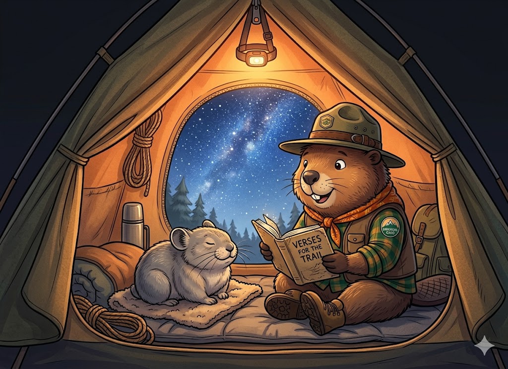
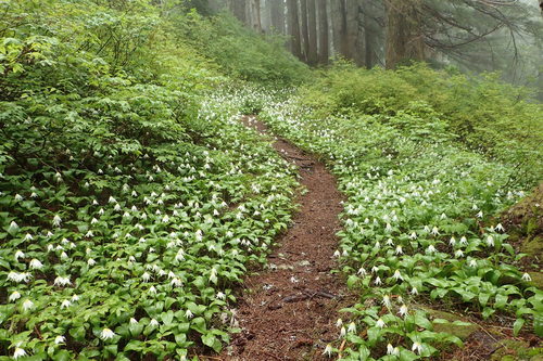
Four days across the wild heart of the Olympics — four passes, forty-three miles, and the last range in the Lower 48 where nothing quite exists like this anywhere else.
Mark, Aaron, Brad, Marion —
I did my homework on you before I wrote this. Not to be weird about it — because the only trip guides worth writing are the ones written for a specific foursome, and I wanted to know who was going to read it instead of guessing.
Here's what I've got. You're four men from northwest Georgia. You're heading to the opposite corner of the country for four days, four passes, forty-three miles, and a ridgeline that will make most of your Instagram look like low-effort copies of what you saw with your own eyes. One of you is a thirty-year prosecutor, one of you investigates the crimes that prosecutor tries, one of you keeps the machines running, and one of you sells insurance — which, on Day 3, is going to feel like the smartest career choice at the table.
I mention this because I want you to know that this document took your standards seriously. Every mile is NPS-cited. Every pass elevation comes off USGS. Every permit code is verified against Olympic NP's current regulations. The endemic species are pulled from the Washington Native Plant Society and iNaturalist. Beaver Bob is going to show up every few pages and drop jokes, but the underlying facts hold. Mark — you'd win an evidentiary challenge on anything in here. Aaron — you'd clear it on a records check. That was the minimum bar because I knew both of you would notice.
The second thing I want you to know: this trip is the opposite of Dalton. Northwest Georgia is red clay and shortleaf pine and humid August evenings. The Olympics are granite, glacier, and cold mountain air that smells like green things. A 12,000-year-old biological island on the far corner of the continent. You're going to see plants and animals that exist nowhere else on Earth. You're going to walk above treeline for most of Day 3. You're going to stand at Grand Pass at 5:25 a.m. on Day 4 and watch Mount Olympus turn pink from a distance of sixteen miles and you are going to remember the four of you being there for as long as you remember anything.
Here's my thesis for the trip, written out front so nobody has to ask me later: the Grand Loop is a heist. Four guys. Specific skills. A complicated system (Recreation.gov, the April 15 permit window, four mountain passes, weather, bears, deer that eat t-shirts). One shot to pull it off clean. Every heist movie has the same four archetypes — the leader, the inside man, the tech guy, and the face. You already are those four archetypes, which I think is half the reason this trip is going to work. The other half is that you like each other enough to walk 43 miles without anyone quitting.
One last thing. I wrote this document because a trip like this deserves to be done carefully, and because the four of you are the kind of foursome that only really exists once in a lifetime. Twenty-plus years of knowing each other comes down to about ninety-six hours on a ridge. Don't waste them. Go slow on Day 3. Wake up for the alpenglow on Day 4. Look after each other when someone's quiet. Trust Marion to tell you when the storm's coming in.
The rest of this document is the practical scaffolding. Maps. Elevation. The permit script for 6:55 a.m. on April 15. The field guides. The sky chart. The daily scavenger hunts with working progress bars. The Camp Provisions protocol. The Campfire Scripts. The bullshit topics to use up long trail miles. And, at the back: a star to name together on Night 3 and a letter from me to read at sunrise on Day 4.
Carry it light. Look up often. Tell each other you're glad you came.
— Carter
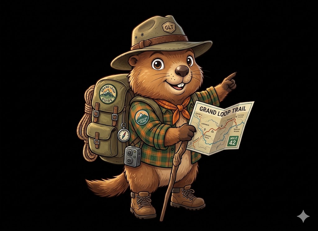
Bob will show up throughout this document with Trail Dispatches — short, honest, occasionally blunt takes on the country you're walking through and the men walking through it. He knows these ridges. He also knows you: Mark the prosecutor, Aaron the investigator, Brad who keeps the systems running, Marion who sells insurance. He's going to give each of you exactly the amount of grief you've earned.
Listen to him when he's being serious. Laugh at him when he's not. He can handle it.
Three passes in ten miles with 4,200 feet of vertical. Parties that leave Dose Meadows after 7 AM get caught descending Grand Pass in afternoon storms. Be on the trail by 5:30 AM, headlamps on. No negotiation.
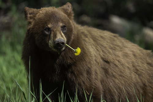
Black bears have figured out that tents contain ramen. One sloppy night at Falls Camp trains a bear who ruins the next party's trip. Food, trash, toothpaste, deodorant — all in the canister, 100 feet from tent, every night.
Olympic weather shifts in minutes on Lillian Ridge and Cameron Pass. If you hear thunder, get below ridgeline immediately — don't finish the traverse. Marion is your weather boss. Treat his calls like court orders.
— Bob, who has seen all three of these go wrong. Don't be a trip report I tell at Granny's Cafe next fall.
When this hits zero, the entire summer's worth of Olympic wilderness permits goes live. Grand Valley sells out in under an hour. Be logged in on two devices at 6:55 a.m. PT.
"Day 3 rocked me. Getting over Grand Pass was grueling, especially after the two other passes of the day. For anyone else doing this trip, I would consider spreading it out over one more day if time permits." — Bryce H., Backpackers Review, 2018.
Day 3 is ten miles and 4,200 feet of gain across three passes: Lost (5,600′), Cameron (6,450′), and Grand (6,450′). It is the crux of the trip. Our itinerary is built to handle this — short Day 2 to Dose Meadows leaves you fresh; Night 3 at Grand Lake means the day ends at a bed rather than another climb — but if the crew is mixed-strength, consider the Foursome Modification (26-mile, 3-pass version starting at Obstruction Point). Section below.
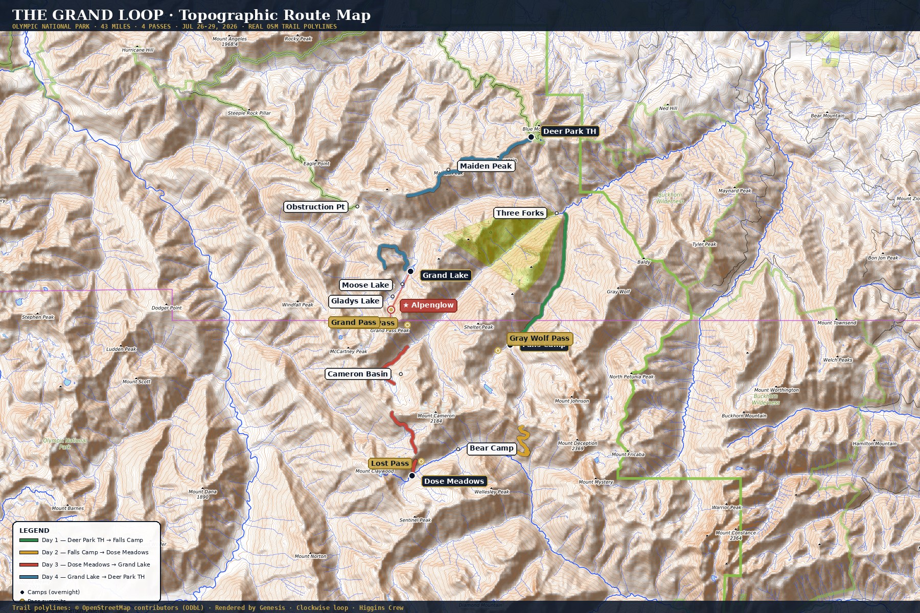
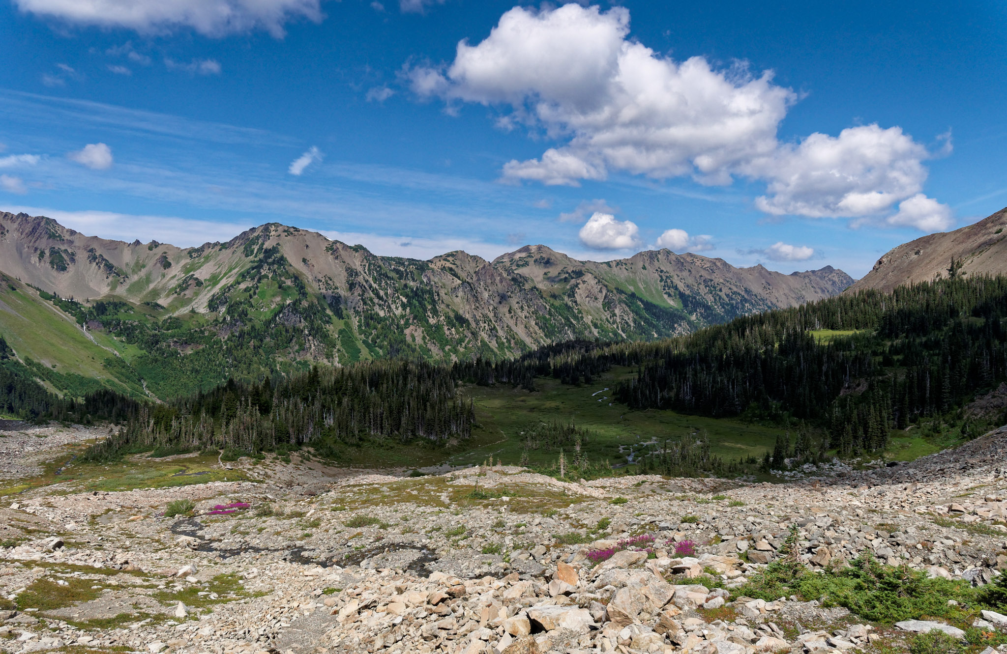
Clockwise from Deer Park. The aesthetic order of this loop is non-negotiable — it saves the best ridgeline (Lillian) for the final day, keeps Mount Olympus in the south where the light is best on the approach passes, and puts the steep descent into Three Forks on fresh legs rather than exhausted knees. On the map, you are heading south first, then east, then back north. In 2024 the WTA's most-detailed trip report of this route also ran it clockwise — same reasons.
The real loop, traced. Route plotted from 15 NPS-verified waypoints (campsites) and peakbagger LIDAR (summits) on OpenTopoMap base — real shaded relief, real contour lines, real trail position. Day 1 green, Day 2 gold, Day 3 red (the hardest day), Day 4 blue. Gold circles = pass summits. Red star = Day 4 alpenglow spot.
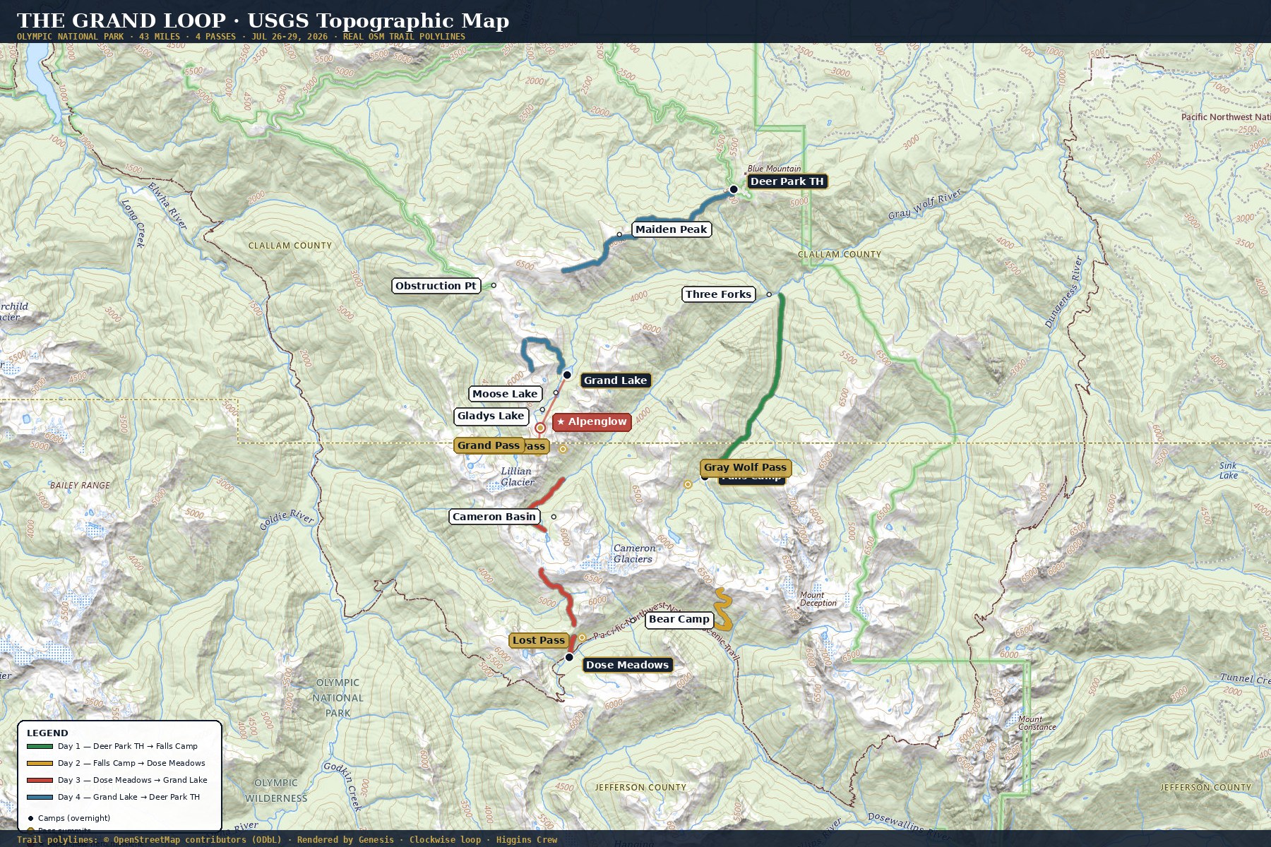
Same exact route, rendered on USGS National Map tiles. Federal data, LIDAR-derived contours. Use this one for cross-referencing with your paper USGS quads.
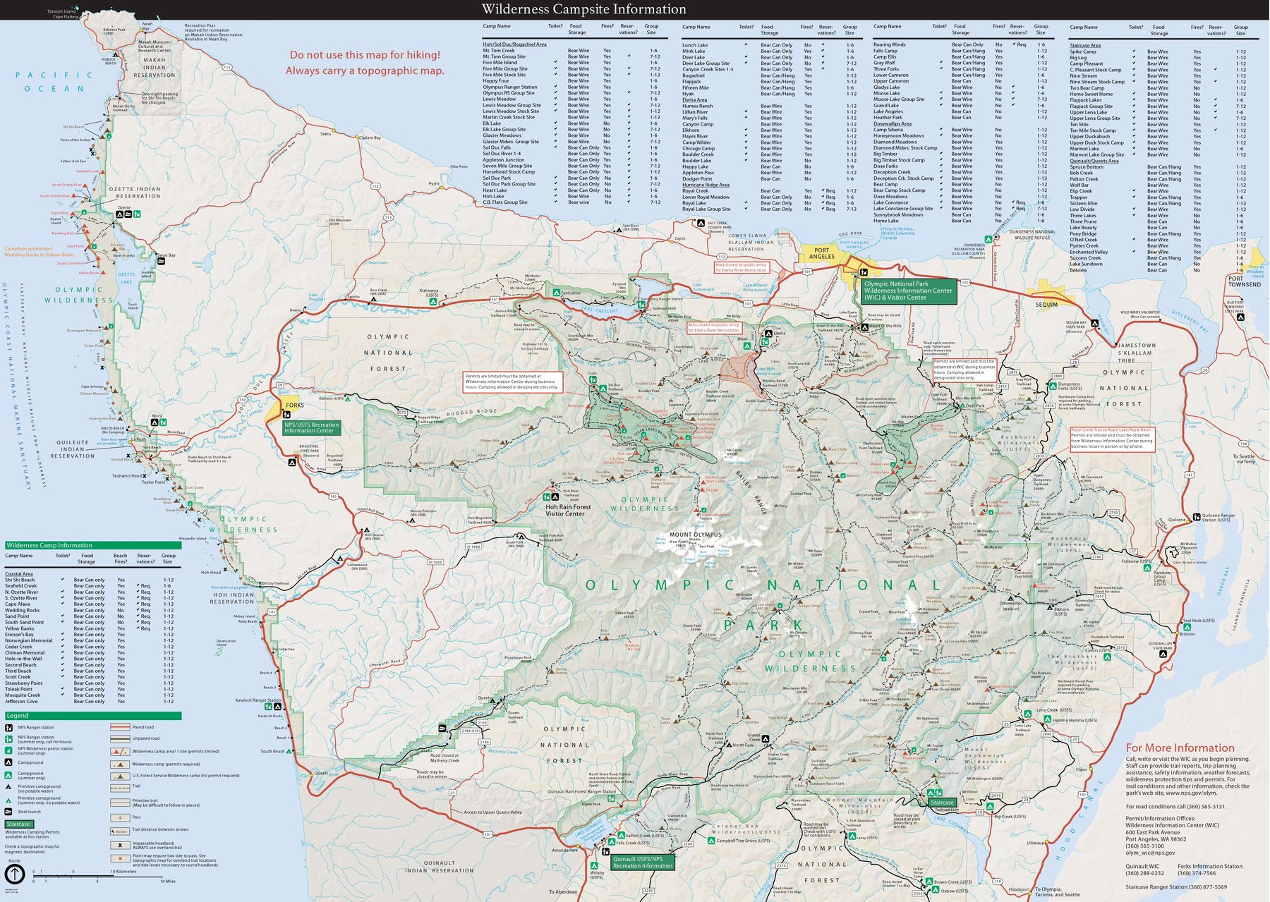
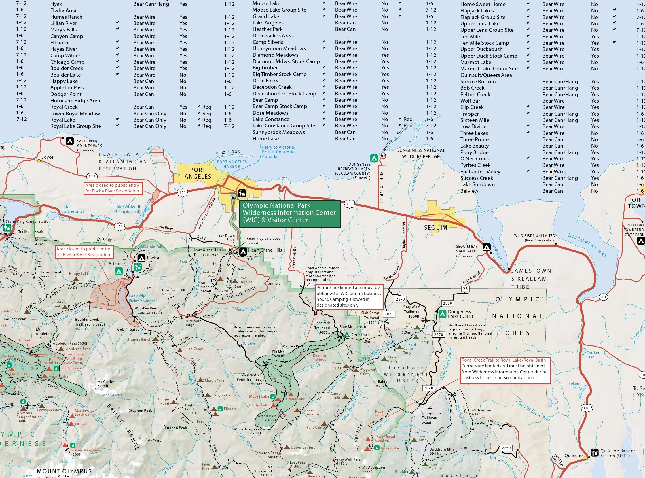
The official NPS Wilderness Trip Planner Map — the same map the Wilderness Information Center hands you at permit pickup. Source: nps.gov/olym (public domain). Your Grand Loop sits in the northeast corner.
Read the clockwise loop: Deer Park (NE) → drop south via Three Forks trail → southwest along Gray Wolf River to Falls Camp → climb west over Gray Wolf Pass → descend to Dose Meadows (south of the loop) → climb NE over Lost, Cameron, Grand Passes → camp at Grand Valley → traverse Lillian Ridge north along Obstruction Point back to Deer Park.
These are the authoritative maps. Brad: download these to Gaia and CalTopo BEFORE the trip. No cell service anywhere on the loop.
The profile makes the trip's geometry obvious. Day 1 is a steep descent and a gradual climb. Day 2 is a long pull over Gray Wolf Pass and a gentle glide down to Dose Meadows. Day 3 looks like a heart monitor — up, down, up, down, up, down — that's three passes in ten miles. Day 4 climbs steadily out of Grand Valley and traverses high to the finish.
| Day | Segment | Miles | Gain / Loss | Camp |
|---|---|---|---|---|
| 1 | Deer Park → Three Forks → Falls Camp | 10.0 | +2,000 / −3,400 | Falls Camp (3,800′) |
| 2 | Falls Camp → Gray Wolf Pass → Dose Meadows | 11.0 | +3,200 / −2,800 | Dose Meadows (3,500′) |
| 3 | Dose Meadows → Lost Pass → Cameron Pass → Grand Pass → Grand Lake | 10.3 | +4,200 / −3,900 | Grand Lake (5,100′) |
| 4 | Grand Lake → Obstruction Point → Hurricane/Lillian Ridge → Deer Park | 11.4 | +3,200 / −2,500 | — |
Photo is stored locally in your browser · stays on your device · not uploaded anywhere
Leave Port Angeles by 8:00 a.m. The Port Angeles Wilderness Information Center (WIC) on Mt. Angeles Road (3002 Mount Angeles Rd, (360) 565-3100) opens at 8:00 — if you haven't picked up your permit and bear cans the afternoon before, do it now. The drive up Deer Park Road takes about 45 minutes: 8.7 miles of paved road, then 9.3 miles of narrow, switchbacked gravel climbing 5,000 feet. No RVs, no trailers, and not in a lowered sedan. Stop at the Deer Park Ranger Station (usually unstaffed) to sign in. There is no potable water at Deer Park — carry 2 liters each from Port Angeles or fill at the fish hatchery on the way.
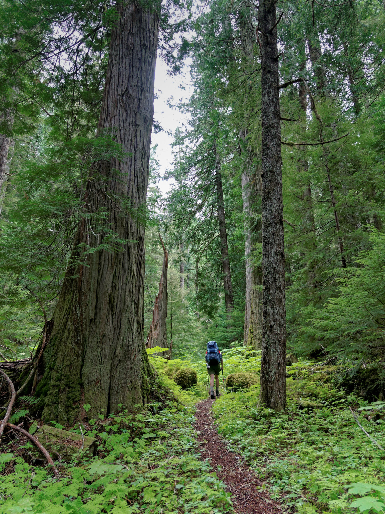
The loop begins in a deception: you'll drop 3,400 feet on Day 1. It's counter-intuitive — you just drove up a mountain, and now you're walking down into a valley. Trust the plan. The trail descends through silver fir and mountain hemlock into the upper Gray Wolf River canyon. By mile 5 you're at Three Forks, the confluence of Cameron, Grand, and Gray Wolf creeks at 2,200 feet — the low point of the entire loop. Filter water here; you'll be shaded by enormous Douglas-firs and western red cedars.
From Three Forks, the trail turns upstream along the Gray Wolf River — a gentle, steady climb of about 1,600 feet over 5 miles. Cedar Lake (1.7 miles off-trail) is an optional side trip if energy remains; otherwise continue to Falls Camp at mile 10.
Falls Camp has a navigational oddity you need to know: there is no sign. Trip reports universally warn about this. Look for an open rocky area on your left as you walk along the trail, just before a waterfall in Gray Wolf River. GPS reference: approximately 47.84° N, 123.18° W. Established tent sites, a pit toilet, abundant water from the river. No fires.
Sunset at Falls Camp arrives early because you're in a deep canyon — the rim blocks direct sun by about 7:30 p.m. even though the sun doesn't set over the horizon until 9:05 p.m. The golden hour before that turns the waterfall into a stream of molten gold. Set up a long exposure.
"What did Day 1's trail teach you about how you pack — your bag and your mind?" Write three sentences in your journal before sleep. You're going to notice things about how each of the other three packs that you never noticed in twenty years of knowing them. That's the trail working.
Take 15 minutes after dinner. The four of you walk the 200 yards from Falls Camp to the viewing ledge above the Gray Wolf River waterfall. The sun is already off the canyon rim. The air is cool. Nobody else will be there. Stand along the edge. Don't take pictures. Don't talk for at least three minutes. This is Day 1 of four days away from courtrooms, servers, claims, and clients. Let that fact land on all four of you at once.
Ten miles and thirty-four-hundred feet of descent later, here you are. Falls Camp is where the trip starts to feel real — the road is three hours behind you, you can hear the Gray Wolf River running, and the four of you are about to have your first shared dinner under a sky that has no streetlights in it.
Mark, you cooked well. Don't get comfortable — Aaron's turn tomorrow. Brad, I see you re-tightening your pack straps. They are fine. Leave them alone. Marion, the weather forecast for Day 3 is already looking good, and I know you've checked it three times — so have I. Sleep well. Tomorrow is Gray Wolf Pass and the first real view of what you came for.
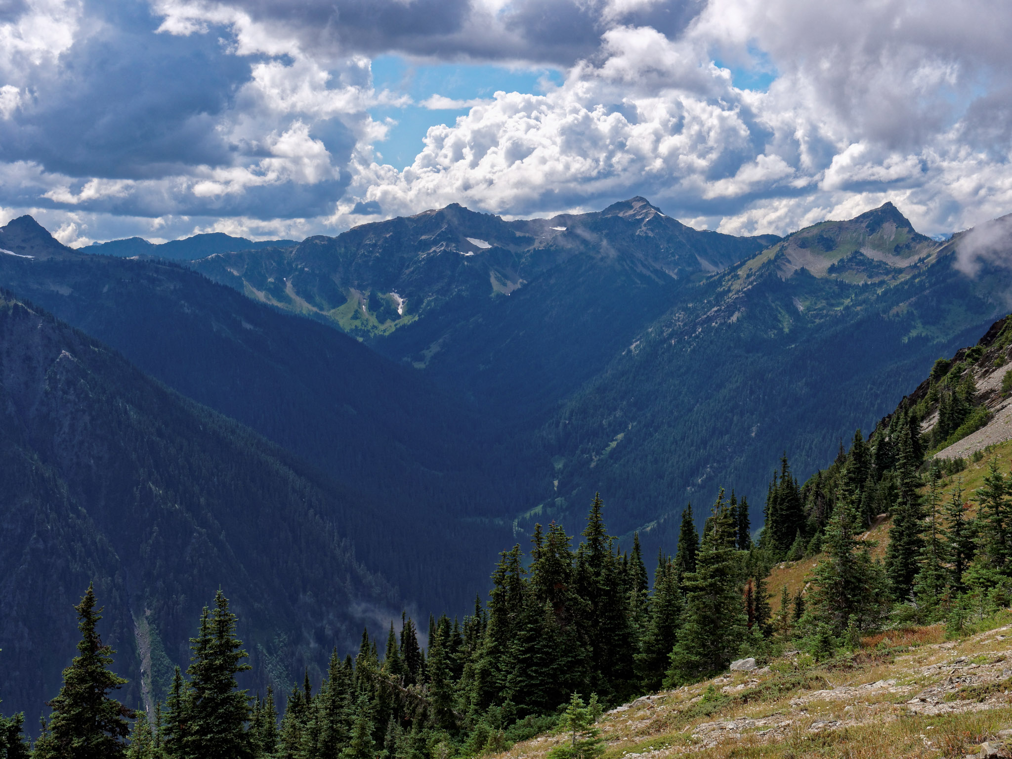
On the ridge by 7:00 a.m. The climb to Gray Wolf Pass (6,200′) is four miles of steady elevation gain. The first two are forest; the second two break into subalpine meadow. You'll feel the thinning air past 5,000 feet. Drink water. The pass itself is a grassy saddle with the pay-off view of the 2021 trip report's favorite descent of the trip: north toward the Bailey Range and Mt. Anderson.
From Gray Wolf Pass, the trail drops 2,800 feet over 7 miles into the Dosewallips River valley. You'll pass Bear Camp around mile 14 (water available; many trip reports use it as a lunch stop). The trail meets the Dosewallips River Trail and turns upstream into a broad, green, meadow-lined valley. Dose Meadows sits at 3,500′ in a wide opening in the forest.
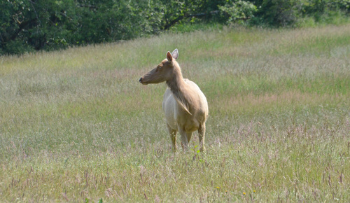
Established tent sites in the meadow edge; pit toilet; cold, clear water from the Dosewallips. The river is ankle-deep in July and safe to wade. Look for Roosevelt elk in the meadow at dusk (lower elevation = elk country begins here).
If the crew pulls into Dose Meadows by 2:30 p.m. and legs feel fresh, the right side-trip is Thousand Acre Meadows — a massive hanging meadow east of Hayden Pass, roughly 5 miles round-trip from camp with about 1,500 ft of gain. Not a designated campsite; not on most maps. Accessed via the main trail toward Hayden Pass, then an unmarked goat trail heading east at approximately 5,300 ft elevation. Climb a small ridgeline, drop into the meadow — and suddenly you're standing in one of the largest open subalpine meadows in the Olympics.
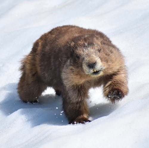
What you'll find: Dozens of marmots (literally — the 2024 WTA trip report counted "nearly 20"), occasional black bears grazing (including cow-with-cubs sightings), wildflower density that rivals Grand Pass, and a view south to Mt. Anderson that frames the whole Dosewallips valley you just walked up. Zero other hikers. Dead silence except wind and marmot whistles.
Alt plan: If Day 2 finishes late, do this as a pre-dawn Day 3 warm-up before the three-pass grind — sunrise from the meadow edge is reportedly extraordinary. Either way: leave no trace, stay on faint paths, and watch your step in marmot-hole country.
The Dosewallips valley is part of the Pacific Northwest Trail corridor. For this one day, you are walking on one of the great American long trails — the PNT runs from the Continental Divide in Glacier to Cape Alava on the Pacific. Some of the people you pass today will be thru-hikers ten weeks out of Montana. Ask them where they slept last night. The answers are worth the question.
The pass-top silence. At Gray Wolf Pass around 11:00 a.m., drop packs. Sit. Eat a second breakfast. Between you and Mt. Anderson (to the south) is three miles of empty air and the whole Gray Wolf valley you just climbed out of. You earned this in five hours. Don't waste it in five minutes.

Today, for one afternoon, you're walking the Pacific Northwest Trail. The PNT runs 1,200 miles from the Continental Divide in Glacier National Park all the way to Cape Alava on the Pacific. Some of the hikers you pass in the Dosewallips Valley are ten weeks out of Montana and smell exactly like that.
If you see a thru-hiker, say hi. Ask them where they slept last night. The answer is always interesting, and they're starved for civilian conversation by the time they get to you.
The Dosewallips River runs forty feet from the meadow edge. After dinner, all four of you walk out there, spread your jackets on the grass, lie on your backs, look straight up. The waning gibbous moon doesn't rise until about 11 PM, so you have a solid hour of deep dark sky — Milky Way arcing southeast to southwest, galactic core just above the horizon, and early Perseids overhead. Don't talk for ten minutes. That's 120,000 light years of sky, and the four of you are underneath it. Mark, bring the thermos. Brad, phone in the tent.
Today you cross three passes — Lost (5,600′), Cameron (6,450′), and Grand (6,450′) — in ten miles. You will climb 4,200 feet and descend 3,900. You'll be above treeline for the middle 6 miles, which means no shade, no water on some sections, and no bail-out. Leave camp by 6:00 a.m. Be over Cameron Pass by noon. Reach Grand Lake before sunset.
Lost Pass is a 2,100-foot climb in 1.5 miles on a primitive (unmaintained) trail. This is the steepest sustained climb of the loop. Take the switchbacks slowly; the grade eases above 5,000 feet. The pass itself is a grassy notch with a short scramble option up Lost Peak (Class 2, 360° view of the Bailey Range — worth it if legs feel fresh).
From Lost Pass, the trail drops 1,100 feet into Cameron Basin — what Climber Kyle called "an alpine wonderland of millions of wildflowers, gentle switchbacks, and murmuring streams." Avalanche lilies in early July, lupine and paintbrush by mid-July. Cameron Creek runs through the middle — load up on water here, because the climb to Cameron Pass is dry.
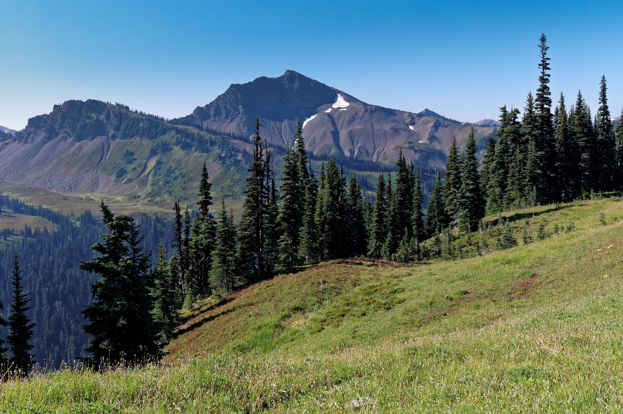
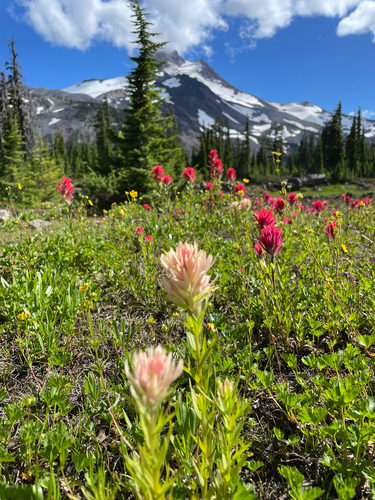
Cameron Pass is the alpine crux. 2,350 feet of gain in 2.5 miles, with the last half mile on loose scree. At the top (6,450′), Mount Olympus fills the southern horizon to your left, and the Bailey Range stretches west. This is the best Mount Olympus view on the loop — if you're a photographer, this is where you want to be at golden hour, but we have to keep moving.
From Cameron Pass, descend 2,350 feet into the Cameron Creek drainage, then immediately climb 2,350 feet again to Grand Pass. This is where Bryce H.'s warning lives. Your legs will feel it. At Grand Pass (6,450′), take the 0.3-mile spur trail up Grandview Peak — unofficially the best view in the park, a 360-degree panorama that includes Grand Valley dropping away below you, the Cameron headwall you just crossed, Mt. Olympus, and on clear days Mt. Baker (a stratovolcano) 70 miles northeast.
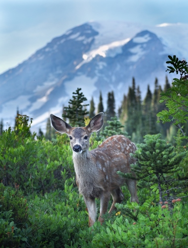
From Grand Pass, the trail drops 1,350 feet in 1.5 miles (take it slow — this is where knees take damage on tired days) to Grand Lake. Campsites around the lake; pit toilet; water from the outlet. Heads up: the mule deer at Grand/Moose Lake are aggressive about salt. They will lick tents, follow you, and eat a sweaty t-shirt if you leave one out. Store sweaty clothes in your bear canister or a dry bag at night.
Write these down tonight before sleep takes you:
1. On the climb up Cameron Pass, where did your thoughts go?
2. What was the smallest beautiful thing you saw today?
3. What does the mountain know that you don't yet?
4. Note one thing each of your trail companions did today that you want to remember.

Three passes in ten miles is how Day 3 looks on paper. What it feels like is different. Here's the truth: each pass is a separate mountain. You don't climb three mountains today — you climb one, you rest, you climb another, you rest, you climb the third. Break it into three projects, not one nightmare.
Between Lost Pass and Cameron Basin: eat something hot. Don't just snack. Make coffee. Boil water for ramen. A hot stomach changes everything about how the next climb feels. This is a 30-year prosecutor move: recover your witnesses before you call the next one.
Today was the hardest day any of you have hiked in years. You're probably asleep by 9:00. Set an alarm for 11:15 anyway. The galactic core of the Milky Way is crossing due south at that hour. Get up. All four of you. Walk to the shore of Grand Lake, 200 feet from your tent. The water will be black. The sky will be white with stars. You'll be looking at the arm of the galaxy you live in from a granite ridge where maybe thirty people total will stand all summer.
Don't narrate it. Don't joke. Just stand there five minutes and go back to sleep. Twenty years from now one of you will bring this up at a dinner and the other three will know exactly which night he means.
This is the move that separates tourists from the crew that tells this story for years. Set an alarm for 5:00 a.m. Put on headlamps, a puffy, water, camera. Leave packs. Hike 0.7 miles up the Lillian Ridge spur from Moose Lake. Find a boulder on the southeast edge of the ridge.
Sunrise on the eastern horizon is 5:27 a.m. in mid-July. But the eastward-facing peaks above Cameron Basin catch direct sunlight 10–12 minutes earlier. At 5:15 a.m. the cirque spires behind you go from black to orange. At 5:25 a.m. Mount Olympus, due south and 16 miles away, goes pink while the valley is still in shadow. Peak glow lasts 7–10 minutes.
This is the photograph of the trip.
5:25 a.m. Alpenglow on Olympus. The four of you on a ridge above Grand Valley, watching 8,000 feet of glacier turn pink in silence. Almost nobody on this loop wakes up for it. You will.

Today is the longest day statistically but the easiest emotionally. Ridge walking at 6,000 ft from sunrise to finish. Cool air. Views of Canada, of a volcano, of the strait, of everything you just crossed.
The temptation will be to hustle because the car is visible. Don't. Walk slowly. Lillian Ridge is the kind of place where later, when you're sitting in the Dalton courthouse on a December Tuesday, you'll want to remember specific things — the color of a particular patch of heather, the way the wind sounded in the notch past Maiden Peak. Walk slowly enough to store specifics.
This is the one. Every mile, every pass, every permit-lottery headache has been a scaffold to get you to this fifteen-minute window on a specific ridge. Alarms set for 4:50. Headlamps. Puffys. Thermos. Hike 0.7 miles up the Lillian Ridge spur from Moose Lake in the dark. Find four boulders facing southeast.
You will be cold. The sky will be the color of an old bruise. Mount Olympus will look fake — like somebody painted it there. Then, starting at 5:22 a.m., color will climb the glacier from bottom to top as if someone were pouring honey on it.
Here's what you do: stand in a line along the ridge. Don't talk. Don't take pictures for the first five minutes. Just watch. When it starts to fade, one of you turn to the others — doesn't matter who — and say out loud: “Good, gentlemen.” Then walk back to camp. That's the moment. You'll carry it.
Back to camp for breakfast, then break camp around 9:00 a.m. The climb to Obstruction Point (6,100′) is a steady 1,000 feet over 3 miles of open ridge. This is the beginning of Lillian Ridge.
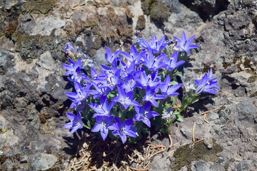
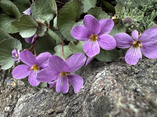
For the next 6 miles you walk an open alpine ridge. This is what the whole loop has been building toward. To the north: the Strait of Juan de Fuca, Dungeness Spit curling into it, and Vancouver Island (Canada!) on the horizon. To the northeast: Mount Baker, a glaciated 10,781-foot stratovolcano, 70 miles away. To the south and west: every peak you've just crossed. To your feet: Piper's bellflower growing from cracks in granite, Flett's violet in the crevices — endemic species you are now among the small number of humans who have ever seen in the wild.
Here's the thing older guidebooks will tell you and you won't see: mountain goats. For a century there were goats on Lillian Ridge — a non-native population introduced by hunters in the 1920s. Between 2018 and 2022, Olympic NP removed all 548 of them. The meadows are quietly healing. What you don't see has its own story.
From Obstruction Point, follow the Obstruction Point-Deer Park Trail east. The path undulates over Elk Mountain and Maiden Peak (5,500′) — knife-edge ridge walking with drop-offs on both sides. At mile 10, the forest closes back in and the trail descends to Deer Park at 5,300 feet and your car. There is no water on Lillian Ridge for 7 miles between Obstruction Point and Deer Park — leave Grand Lake with 3 liters each.
If any crew member isn't a regular alpine backpacker, consider the modified itinerary below. It cuts Gray Wolf Pass (the longest Day 2 climb) and Falls Camp, starts at Obstruction Point, and preserves every hero moment of the trip: Grand Pass, Cameron Pass, Lillian Ridge, the sunrise. 26 miles, 3 passes, 4 days, and permit availability is actually better than the full loop because you skip the lottery-popular Grand Valley night.
| Day | Segment | Miles | Camp |
|---|---|---|---|
| 1 | Obstruction Point TH → Lillian Ridge → Moose Lake | 4.2 | Moose Lake |
| 2 | Day-hike Grand Pass + Grandview Peak + Cameron Basin; return | 8.0 | Moose Lake (layover) |
| 3 | Moose Lake → Grand Lake → Badger Valley → Roaring Winds | ~7.0 | Roaring Winds (5,950′) |
| 4 | Roaring Winds → Maiden Peak → Deer Park TH (shuttle) | 6.0 | — |
This version still gives you four days in the high country, but with a layover day at Moose Lake. On the layover, the group can either day-hike to Grand Pass (hardest option, hero-worthy) or nap in the meadow and read. Everyone gets the trip that matches them.
On or before the fifteenth day of April, in the year Two Thousand Twenty-Six, at seven hundred hours Pacific Time, the National Park Service will release the entire summer season inventory of Olympic wilderness permits via Recreation.gov. Petitioners Higgins et al. (hereinafter, “the Crew”) shall appear through electronic means and move for reservation of three (3) consecutive overnight wilderness nights in the Grand Valley Management Area.
Carter Hill, on behalf of the Higgins Crew, respectfully submits the following procedure for securing the subject permit. Said procedure is based on direct consultation with the Olympic NP Wilderness Information Center ((360) 565-3100) and review of Recreation.gov's terms of service as updated December 2025.
— So filed, this document, by Carter Hill, on behalf of the Higgins Crew.
Dalton, Georgia to Deer Park, Washington. 2,500 miles, three time zones, one day of travel. Here's the path of least resistance for a foursome.
| Leg | Detail | Time |
|---|---|---|
| Dalton → ATL | Drive (or one of you drops the car at Hartsfield long-term) | ~1h 45m + parking |
| ATL → SEA | Direct flight on Delta (4–6 daily). 5h 20m nonstop. Book for arrival by noon Pacific if possible. | ~5h 30m |
| SEA → Port Angeles | Rental car (pick up on airport property), drive via Edmonds-Kingston ferry (scenic, $20/vehicle) or all-highway via Tacoma (longer but reliable) | ~3h via ferry / 4h all-highway |
| Port Angeles overnight | Stay at the Olympic Lodge (140 Del Guzzi Dr) or Red Lion Harbor (221 N Lincoln St) — pick up permits and bear cans at the Wilderness Information Center before 4:30 p.m. close. | — |
| Port Angeles → Deer Park TH | Drive 18 mi via Deer Park Rd (last 9 mi gravel). Park, hit trail. | ~45m |
Fly ATL → SEA on a Sunday morning. Arrive SEA by noon Pacific. Pick up the rental. Catch the 2:30 Edmonds-Kingston ferry. Dinner in Port Angeles at Next Door Gastropub on First Street by 7:00. Lodge check-in. Early night. Monday morning: Wilderness Information Center at 8:00 sharp for permits + bear cans + a ranger briefing. On trail at Deer Park by 11:00. You've earned a hot meal and a real bed before you sleep on the ground for three nights.
The rest of your pack contents go in a checked duffel. Weigh the duffel at home — stay under 50 lb to avoid overweight fees. Fuel canisters CANNOT fly; buy 2× 100g canisters at the REI Seattle Flagship (222 Yale Ave N, (206) 223-1944) or Brown's Outdoor in Port Angeles (112 W Front St, (360) 457-4150) on arrival.
Rent a mid-size SUV or larger. Four men plus four packs fit in a Ford Escape or equivalent, tight. A Ford Explorer or Chevy Tahoe is more comfortable. Do NOT rent a sedan — the last 9 miles of Deer Park Road are gravel and rutted. You want ground clearance.
LIVE FORECAST LINKS
48 hours out: Marion checks all five links above. 24 hours out: Re-check. Share the summary with the group on a text thread. Morning of Day 1: Final check from the lodge before driving up. If forecast shows sustained 40+ mph ridge winds or thunderstorms for Day 3 afternoon, adjust the plan — start Day 3 earlier or consider the foursome modification. Risk officer owns the call.
April 15, 2026 at 7:00 a.m. Pacific Time (10:00 a.m. Eastern). This is the moment the entire summer season's Olympic wilderness permits go live on Recreation.gov. Grand Valley (Grand Lake, Moose Lake, Gladys Lake) is a quota area — popular July weekends sell out in less than an hour. For a July 2026 trip, the crew needs a member at a laptop at 6:55 a.m. Pacific on April 15, 2026, with a Recreation.gov account already created and the itinerary pre-planned.
As of December 2025, Olympic National Park requires Animal-Resistant Food Containers (ARFCs) in ALL wilderness areas, not just the traditional quota zones. This is a 2026 change. Hanging food bags and Ursack-style soft containers are no longer compliant. Most published trip reports will not reflect this yet. Source: NPS Wilderness Food Storage, last updated Feb 26, 2026.
Approved canisters include: BearVault BV425 / 450 / 475 / 500, Bearikade Weekender MKII / Expedition MKII, Garcia Backpackers' Cache 812, Bare Boxer Contender 101, Counter Assault Bear Keg, Lighter1 Big Daddy, REI Traverse Modular (25200), UDAP No-Fed-Bear.
15 waypoints including all passes, camps, water sources, and the alpenglow spot. Import into Gaia GPS, Garmin inReach, or any modern GPS device. Brad, this is your department.
For a crew of 4 / 3 nights: Two BV500s shared (one between two people) is standard. Rent free at the Port Angeles WIC — first-come, first-served, so arrive 30 min before opening.
| Road | Condition | Call Before Trip |
|---|---|---|
| Deer Park Road (Day 1 TH) | 18 mi, last 9 mi gravel — steep, narrow, windy. Sedan-passable but slow. No RVs or trailers. | Opens late June; confirm via NPS Road line (360) 565-3131 |
| Obstruction Point Road (Day 4 option) | 8 mi gravel, drop-offs, often one-lane. 4WD strongly recommended. | Typically opens early July; call (360) 565-3131 |
| US-101 to Port Angeles | Paved, two-lane, scenic. Seattle to PA via Edmonds-Kingston ferry: ~3.5 hrs. | Ferry schedule: wsdot.com/ferries |
Every store, every phone number, every address for the trip. Hyperlinked and click-to-call. Bookmark this section on your phone before the trip — that's your single source of truth for anything you need to buy, eat, sleep, or ask about between Sea-Tac and the trailhead.
Sunday arrival: SEA → Edmonds-Kingston ferry → Port Angeles. Check into hotel. Dinner at Next Door Gastropub. Monday morning: Breakfast, then WIC at 8:00 AM for permits + bear cans. Stop at Country Aire / Safeway for food + Brown's Outdoor for fuel canisters. Drive Deer Park Road. Boots on dirt by 11:00 AM.
Both of you add these phones to your contacts under a single group: "Higgins Grand Loop". Marion gets read access via shared text thread. That way any one of the four of you can tap-to-call anything — the ranger station, the hotel, a burger place — without fumbling for search terms in the parking lot of a Safeway with bags of Mountain House in hand.
Four men. Four passes. Four specific jobs on the trail. Rotate nothing. Each man owns his domain all four days — it's how four professionals from four different domains turn into a foursome that moves smooth. Heist team. Every member has a role.
Owns the map. Calls decisions at trail junctions. Picks the pace. Calls breaks. Knows where the next water is. When the four of you are standing at a fork on Day 3 and two paths look equally plausible, Mark reads the map and picks one. Thirty years of Conasauga Circuit energy doesn't hurt.
Eyes up. Notices what the rest miss. Scouts 50 yards ahead when the trail's in doubt. Owns the water filter; ensures everyone has water before each climb. Spots the first marmot, the first Piper's bellflower, the specific shape of the cloud that's about to throw weather at you. Investigators see things. Use him.
Owns every device. Phones, GPS, inReach satellite messenger, headlamps, batteries, power bank. Knows the charge state of everything. Knows when to put it all away (which is most of the time). Downloads the offline Gaia maps before the trip. When Marion's headlamp dies at 11 p.m. on Night 3, Brad has spare AAAs.
Owns the first aid kit. Reads the weather. Inventories the food. Calls it when a day needs to be shorter. Is the one who says “we should probably head down” when the clouds build over Cameron Pass. Actuarial thinking is exactly what keeps a foursome out of the bad outcome. Insurance men know the low-probability high-cost event. Trust him.
Composite quotes from years of knowing these four men. Print them out. Read them aloud at Camp Night 1. Each man's line is what he'd tell you, in his own voice, about why this trip matters.
Brief profiles. Bob wrote half of these — he's seen your type before.
What he brings: Thirty years of prosecuting cases that end most people at fifty. One hundred plus jury trials. Eighty-percent conviction rate as lead. Admitted to the Georgia Court of Appeals and the Supreme Court of Georgia. Teaches police academy courses on report writing and courtroom testimony.
What the trip gives back: Four days where nothing has to be proven beyond a reasonable doubt. The mountains won't argue. He'll be surprised how much that matters.
What he brings: A career of noticing things the rest of the room misses. Scene reconstruction. Witness interviews. Getting the story right by asking the one question the subject wasn't prepared for.
What the trip gives back: A landscape where nothing is hiding anything. You notice things and the things just are. The marmot is a marmot. The bear is a bear. The flower is exactly what it looks like. Nobody is lying to you for four days.
What he brings: The guy who keeps the invisible things running — the systems, the uptime, the migrations, the things that nobody notices when they work and everybody hates him for when they don't.
What the trip gives back: Four days where nothing depends on him being reachable. No on-call. No pager. No ticket queue. The signal will go down and the world will hold. He'll notice at some point on Day 2 that he doesn't miss it, and the noticing will surprise him.
What he brings: A career of quantifying risk for other people's bad days. Most people think insurance is paperwork. Marion knows it's really: thinking ahead for people who don't, so they don't have to. He's the one reading the Day 3 forecast three nights in a row. He's the one who remembered the inReach.
What the trip gives back: The actuarial math on the Grand Loop reads something like this: 23% chance of mild regret on Day 3, 77% chance of earning a story he'll tell for thirty years. That's a favorable spread. He booked the trip. The math agreed.
Heist-team foursomes have a specific chemistry. You need a leader (Mark), an inside man who sees what others miss (Aaron), a tech guy who owns the tools (Brad), and a risk manager who plays the percentages (Marion). That's not a coincidence. That's literally the structure of every good team, from Ocean's Eleven to a successful homicide trial to a four-man Olympic traverse. You're already the team. All you have to do is walk.
Four men, four cameras, four perspectives. Each of you has five specific shots to capture — matched to how you see the world. Check them off as you get them. At the end of the trip, combine all 20 into a single shared album. That's the real souvenir.
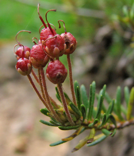
The Olympics rose above the ice during the last glaciation. When the sheet retreated 12,000 years ago, the range stood alone — cut off from the Cascades by Puget Sound, cut off from the coast by the rain shadow, cut off from the north by the Strait of Juan de Fuca. Species that were on the mountain when the ice retreated stayed. They evolved in isolation. Nine vascular plant species and several mammals now exist nowhere else on Earth.
This is the story you are walking through. Every Olympic marmot you see, every Piper's bellflower in a rock crack, every Flett's violet — these are living fossils of that separation. No other Lower-48 mountain range has this density of endemism. Frame the trip this way and it becomes more than a backpack: it becomes a small pilgrimage to a Galápagos of the temperate north.
If your guidebook was published before 2020, it will tell you to watch for mountain goats on Lillian Ridge. Between 2018 and 2022, Olympic NP removed 548 non-native mountain goats — 325 translocated to the Cascades, 175 lethally removed 2020–22. The goats were introduced by sport hunters in the 1920s, a colonial intrusion on an ancient ecosystem. The park is quietly healing. What you don't see has its own story.
All photographs: Wikimedia Commons & iNaturalist (CC BY-NC licenses) · downloaded locally; species identifications verified by visual audit.
| Species | ID | Where |
|---|---|---|
| Avalanche lily (Erythronium montanum) | White six-petaled drooping lily, emerges as snow melts | Cameron Basin, Dose Meadows |
| Glacier lily (Erythronium grandiflorum) | Yellow cousin of the avalanche lily | Same zones, slightly drier sites |
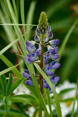
| Subalpine lupine (Lupinus arcticus) | Purple spike flowers, meadow carpets | Cameron Pass meadows, Gray Wolf Pass |
| Magenta paintbrush (Castilleja parviflora) | Hot pink/red bracts | All subalpine meadows |
| Sitka valerian (Valeriana sitchensis) | White cluster flowers, tall stalks | Dose Meadows, stream sides |
| American bistort (Bistorta bistortoides) | White club-shaped flowers in meadow grass | Grand Valley lake margins |
| Pink mountain heather (Phyllodoce empetriformis) | Bell-cluster cushions on rocks | Lillian Ridge, high passes |
There is no peak bloom in the Olympics — species rotate through the summer. The east Olympic meadows (where the Grand Loop runs) melt out first, about 2 weeks before the west. Mid-July 2026 is "second-flush" timing: the avalanche lilies are giving way to lupine and paintbrush; bear grass is just starting. Different species every week. Bring a small wildflower guide for the zip pocket of your hip belt. Noticing them becomes a game.
If you picked these dates at random, you got extraordinarily lucky. Here's why.
The Olympic Peninsula in late July has 15+ hours of daylight. Here's exactly when to be awake. All times Pacific, calculated for the center of the loop (47.95°N, 123.25°W). Alpenglow is the 12-minute window right before official sunrise when Mount Olympus turns pink. Do not miss Day 4 — July 29 at 5:13 AM.
Five days at a glance — night, twilight, golden hour, daylight, evening, and where you'll be during each. Travel day through alpenglow exit. Pass summits marked with gold circles. The Day 4 alpenglow is the red triple-bang.

Set four alarms for 4:55 AM on Day 4 morning (July 29). You need to be standing and facing south from Grand Pass by 5:10 AM. Mount Olympus will begin turning pink at approximately 5:13 AM. The pink peaks at 5:17 AM. The first edge of direct sun hits the summit at 5:19 AM. Then it's just another mountain until next year. Marion has the weather call the night before — clear sky, it's on. Overcast, sleep in and cry about it on the drive home.
Mark, this section starts with your guy. Everything after Dixie is a curated prep playlist — one video per topic, no fluff. The playlist totals about four hours. Watch in any order. Watch on the plane. Watch over coffee on a Saturday morning.
Dixie forgot more about backpacking logistics than most guide services will ever know. She's hiked the Appalachian Trail (2015), the Pacific Crest Trail (2017), the Continental Divide Trail (2018), plus the Camino, the Florida Trail, the Pinhoti, the Foothills, and most recently the Arizona Trail. Southern drawl, zero ego, real advice. If you can only watch one video before this trip, it's her "Backpacking Basics" — four hours, everything you need.
If Brad only watches one. If Marion only watches one. If anyone only watches one. This is it.
Handpicked from 500+ videos. These are the ones with real replay value — funny, practical, and honest.
The Grand Valley is the most bear-dense camp on the loop. This is non-negotiable viewing.
Day 3 exposes you above treeline for six miles. Marion, this is your domain.
Meet the locals before you meet them.
Andrew Skurka is the professional's professional. Brad will appreciate his systems-thinking.
Visual context of the exact route. Watch Backpackers Review before you go — same photographer whose images are throughout this document.
Put on while cooking dinner Saturday night. Get the mood.
Mark, I know you. You're going to watch Dixie's four-hour Backpacking Basics in one sitting. Fine, but don't let Brad watch it with you — he'll pause it every five minutes to cross-reference her gear list with his. Aaron, watch the SOS video with Marion; you two are the crew's risk-management pair.
Here's your minimum-viable viewing list if you're doing this in an hour: Dixie's Sawtooth SOS (30 min), the REI bear video (5 min), the NPS lightning video (2 min), and the 4K Grand Loop thru-hike (however long — put it on mute on a second monitor while you're working). That's the hour. Everything else is bonus.
Music for the drive up Deer Park Road (gets you in the mood). Music for the quiet moments at camp (ambient, not demanding). Music for the drive home (victory lap). Carter's picks, not an algorithm's. Queue these up on Spotify, Apple Music, or YouTube Music before you leave.
I've watched a thousand parties roll through these meadows. Here's what separates a good crew from a crew that almost ruined it: food goes in the canister before you go in the tent. Every night. Not some nights. Every. Night.
Second thing: be the first one up at least once. Mark will make Day 2 coffee because he always does. Aaron, you have Day 3. Brad, day 4 is yours — and you've got three passes in front of you today so I'm giving you a pass on Day 1. Marion, you're on for Day 1. The crew that cooks together stays together.
Last thing: there is a part of Night 3 at Grand Lake where nobody says anything for about five minutes. Don't break it. That's the part of the trip that you're actually going to remember in February when you're driving home from work in the rain.
Four men. Three nights. One loose code of conduct. Not formal, not rigid — just enough structure that nothing has to be renegotiated every evening.
The first one up makes coffee for the crew. No polling. No hedging. You boil the water, you pour four cups, you hand them out. You do not ask if anyone wanted tea. By Day 2 this has become instinct.
Dinners rotate. Mark cooks Night 1, Aaron Night 2, Brad Night 3, Marion Night 4 (which is really the car-ride-home meal). The cook doesn't clean. The other three clean. That's the deal. Brad cannot weasel out of Night 3 by claiming he's "debugging."
Carry one flask between the four of you if anyone wants to. Whisky, bourbon, dark rum — hiker's choice. Four ounces max. It's not a party; it's a punctuation mark. One pour at camp on Night 2 and Night 3 if the mood is right. If nobody drinks, skip it entirely and bring dark chocolate in its place. Nobody has to explain, nobody has to push.
Two tents. Four men. Mark and Aaron in one (work relationship, they already know who snores). Brad and Marion in the other. Switch if anyone asks. Nobody will.
Any man can call a fifteen-minute stop at any time for any reason. No explanation required. No vote. "I need fifteen" and the crew stops. Especially on Day 3. Risk officer (Marion) may call a stop for weather; treat it like a court order.
Kitchen Captain rotation from Camp Provisions, fully spec'd. Every meal planned. Every calorie counted. The target is 4,200 kcal/person/day — you will burn 4,500 on Day 3. Shopping list at the bottom of this section. Buy in Port Angeles at Country Aire Natural Foods or Safeway.
| Day/Meal | What | Cook | kcal/pp |
|---|---|---|---|
| DAY 1 · Sun Jul 26 · Deer Park TH → Falls Camp (10 mi) | |||
| Breakfast | Gas-station egg biscuits + coffee at Port Angeles Safeway before the drive up | In town | 600 |
| Lunch (trail) | Turkey/cheese tortilla wraps (pre-made in Port Angeles) + apple + Snickers | Self | 850 |
| Dinner (Falls Camp) | Mountain House Beef Stroganoff · one each · pita + Nutella dessert | Mark | 1,100 |
| DAY 2 · Mon Jul 27 · Falls → Dose Meadows (8 mi + Gray Wolf Pass) | |||
| Breakfast | Instant oats + peanut butter scoop + raisins + coffee | Mark (leftover duty) | 650 |
| Lunch (Pass) | Summer sausage + cheddar + Triscuits + dark chocolate | Self | 900 |
| Dinner (Dose Meadows) | Mountain House Chicken & Rice + freeze-dried green beans + hot cocoa | Aaron | 1,200 |
| DAY 3 · Tue Jul 28 · Dose → Grand Lake (10 mi · THREE PASSES) | |||
| Breakfast (dark) | Double oats + Pop-Tart + two coffees. Eat heavy. You'll need it. | Aaron | 900 |
| Pass 1 Snack | Picky Bar + jerky + gummy bears + electrolyte mix | Self | 500 |
| Pass 2 Lunch | Peanut butter tortilla + dried mango + salted peanuts | Self | 850 |
| Pass 3 Snack | Snickers + Fritos + caffeine chew · the final push | Self | 600 |
| Dinner (Grand Lake) | Mountain House Lasagna · Night 3 is a FEAST · flask pour if mood is right | Brad | 1,300 |
| DAY 4 · Wed Jul 29 · Grand Lake → Deer Park (8 mi · VICTORY LAP) | |||
| Pre-alpenglow | One Snickers + water + a sip of coffee. You're walking fast. Eat at Grand Pass. | Marion (early) | 300 |
| Grand Pass (sunrise) | Breakfast burrito foil packet (prepped Day 3 night) + instant coffee | Marion | 700 |
| Lillian Ridge Lunch | Last summer sausage + last cheese + last Triscuits + victory Snickers | Self | 900 |
| Post-trail (Port Angeles) | Real burgers at Next Door Gastropub · first shower you smell was 5 days ago | Town | 1,800 |
Country Aire Natural Foods (200 W 1st St · (360) 452-7175) or Safeway (2709 E Hwy 101 · (360) 457-1461):
Mountain House pouches: 8 (2 Stroganoff, 2 Chicken & Rice, 2 Lasagna, 2 backup); Protein bars: 16 (4/person/day); Snickers: 16; Summer sausage: 2 lbs; Cheddar: 1 lb hard cheese; Triscuits: 2 boxes; Pita + tortillas: 12 each; Peanut butter: 1 16oz jar; Nutella: 1 small jar; Dried mango + gummy bears + salted peanuts: 1 lb mix; Oats packets: 12; Pop-Tarts: 1 box; Coffee packets (VIA): 20; Hot cocoa: 12; Electrolyte mix (LMNT or Skratch): 16 packets; Jerky: 2 bags; Picky Bars: 8; Dark chocolate 70%: 4 bars. Total weight / person / 4 days: ~6.5 lbs. Bear canister capacity: tight but fits.
Fuel canisters / gear backup: Brown's Outdoor (112 W Front St · (360) 457-4150) in downtown Port Angeles, or REI Seattle Flagship (222 Yale Ave N · (206) 223-1944) if you land early.
Short readings. One per night. Meant to be read aloud by anyone. Not mandatory — but if the group falls quiet after dinner and nobody wants to start talking, open this and read. It fills the right kind of space.
Every item. Weighed. Checkable. Your progress saves automatically in your browser, so you can pack in stages over a week and the list remembers. Target total pack weight (per person): 32 pounds. Hover over items for notes; check them off as you pack.
Enter each man's final packed weight (including water, food, bear canister, worn clothes off). Target: 32 lbs/person. Leader gets bragging rights. The numbers save in your browser.
25 squares. Click each as it happens. The center is free. Cover a full row, column, or diagonal and call BINGO aloud — preferably on a pass, preferably loud enough for Marion to hear. First full card: buys burgers at Next Door Gastropub post-trail. Progress saves automatically.
| Day | Water Truth | Load Up Here |
|---|---|---|
| 1 | No water at Deer Park — pre-fill in Port Angeles. First source is Three Forks (mile 5). | Port Angeles (2L each) |
| 2 | Water at Falls Camp; then dry climb to Gray Wolf Pass; streams again in Dosewallips valley. | Falls Camp (3L each before pass) |
| 3 | Dry climb to Lost Pass. Streams in Cameron Basin. Dry climb to Grand Pass from Cameron Creek — carry 2L from the creek. | Cameron Creek (2L each) |
| 4 | No water between Obstruction Point and Deer Park — 7 miles across Lillian Ridge. This is the most-overlooked issue on the whole loop. | Grand Lake (3L each) |
Treatment: Sawyer Squeeze or Katadyn BeFree + Aquamira tablets as backup. All sources are alpine and clean by Olympic standards, but giardia is documented. Never skip treatment.
No cell service. No bars anywhere on this loop. A Garmin inReach (or similar satellite messenger) is the single most important piece of safety gear — non-negotiable. Rent one from REI for $35/week if you don't own one.
| Situation | Action |
|---|---|
| Injured but mobile (sprain, mild hypothermia) | Shelter. Treat. Evaluate. Bail point: Dose Meadows is 7 mi down to the Dosewallips TH (out of Deer Park). Signal via inReach. |
| Immobile but stable (broken leg, severe wound) | Shelter in place. Send 2 crew out, not 1. Press SOS on inReach. |
| Life-threatening (head injury, cardiac) | Press SOS on Garmin immediately. Olympic NP Search & Rescue has helicopter assets. |
| Bear encounter (aggressive) | Stand tall. Group together. Make noise. Back away slowly. Do not run. |
| Lightning on a pass | Descend immediately. Don't shelter under lone trees. Lightning position only if caught: crouch on heels, hands over ears. |
| Contact | Number |
|---|---|
| Olympic NP Dispatch / SAR | (360) 565-3121 (24/7 emergencies) |
| Port Angeles Wilderness Information Center | (360) 565-3100 (8a–4:30p daily, summer) |
| Clallam County Sheriff / SAR | (360) 417-2262 |
| Olympic Medical Center (Port Angeles ER) | (360) 417-7000 |
| NPS Road & Weather Line | (360) 565-3131 |
Before leaving Port Angeles, email a designated home contact:
One page. Rip-out ready. Every number, every protocol, every coordinate you need if something goes wrong. Mark carries the primary; Aaron carries the backup. Print two copies before the trip.
Garmin inReach SOS button. Hold 5 seconds. GEOS Monitoring dispatches helicopter.
SOS: hold buttonNon-emergency injuries, trail closures, questions.
[REDACTED:phone_number:dispatch]24/7 dispatch from Port Angeles
Nearest ER, Port Angeles.
[REDACTED:phone_number:hospital]939 Caroline St · ~1 hr from trailhead
US-101 truck break-down / tow.
[REDACTED:phone_number:tow]Deer Park TH: 47.9487°N, 123.2578°W
Grand Pass: 47.9100°N, 123.4150°W
Cameron Pass: 47.9175°N, 123.3442°W
Gray Wolf Pass: 47.8833°N, 123.3167°W
Wilderness Permit #OLY-2026-XXXXXX
Group size: 4 · All nights in Dose Meadows / Grand Valley zones.
Keep copy in every pack.
"Location: [COORDS]. Party of 4. Need: [injury/evac/overdue]. inReach ID: [MARK'S]"
Address to: [Carter + emergency contact]Any injury above the knee that can't weight-bear = PRESS SOS. Don't be a hero. The helicopter is how you get home.
Thunder within 30s = drop below ridge NOW. Crouch on pack, feet together. Wait 30 min after last thunder before moving.
Do: Stand tall, back away slowly, talk calmly.
Don't: Run. Ever. Don't climb trees — black bears are better at it.
Grand Creek, Cameron Creek, Gray Wolf River, Lillian River. All filterable. Lillian Ridge has NO water. Load up at Grand Lake.
If the inReach fails: Nearest trail party carries message to Deer Park TH or ranger station at Hurricane Ridge.
Self-rescue if injury is ambulatory.
Text Carter your exact inReach ID and the name of your emergency contact. File the official itinerary with the Wilderness Information Center at Port Angeles. Carter holds the "overdue" trigger: if no "off-trail" inReach ping is received by 10:00 PM PT on July 29, Carter calls Olympic NP Dispatch at [REDACTED] and reports the party overdue.
The best thing about four days on a trail with men you've known most of your adult life is not the summits. It's the hours between them, when there's nothing to do but walk and talk about things you wouldn't talk about at a Tuesday dinner. Here's your ammunition.
Rule: each question takes at least one mile to answer properly. You do not rush a good bullshit topic. You do not save the funny answer for later. You do not let Brad look it up on his phone. This is real stuff — the kind that, years later, one of you will reference at a wedding toast and the other three will nod immediately because you remember exactly which day and which pass.
Before the truck pulls out of Dalton, each man fills in his answers. Save the page. At Next Door Gastropub in Port Angeles on Day 4, pull this up on Mark's phone and read the predictions aloud. Some will be right. Some will be hilariously wrong. All will be worth the memory. Answers save in your browser.
Four blank pages follow this one, one per day. On the trail, tear them out and fold them into your Rite-in-the-Rain notebook. Or use the prompts and write in your own book. What you wrote on Night 3 is what you'll read on Thanksgiving.
Night 1 (Falls Camp): What did today's trail teach you about how you pack — your bag and your mind?
Night 2 (Dose Meadows): You stood at 6,200 feet on Gray Wolf Pass today. What did you see that you won't see anywhere else?
Night 3 (Grand Lake): On the climb up Cameron Pass, where did your thoughts go? What was the smallest beautiful thing you saw today? What does the mountain know that you don't yet? Note one thing each of your trail companions did today that you want to remember.
Night 4 (Home): What part of the person you were on Day 1 do you want to leave at Deer Park? What part of the person you became do you want to bring home?
This is a private note for the crew, to be opened only at the summit of Cameron Pass on Day 3. Don't read it before. Click to break the seal.
— FOR MARK, AARON, BRAD & MARION —
If you're reading this, you're standing on Cameron Pass. You made it past Lost Pass this morning. Grand Pass is still ahead of you. You're six and a half thousand feet up, in the exact center of the hardest day in the Olympics, and Mount Olympus is somewhere south of here across the Hoh.
I wanted you to open this here because this is the moment the trip becomes something more than a plan on a piece of paper. You walked here. Four of you. Forty-something years of knowing each other. Three thousand miles of geography between here and Dalton. And you are, at this literal moment, closer to the sky than anyone you know back home.
Look around before you read the rest of this. Give yourself thirty seconds. I'll wait.
— § —
Here's what I want each of you to know:
Mark — You built a career making cases for other people. This week, you get to make a case for yourself: that four days of hard walking with three men you trust is worth more than a month of anything else. Closing argument. Jury of one. Verdict obvious.
Aaron — You spend your days looking for the thing in the corner of the frame. Today the frame is the whole horizon. Let your eyes rest. The thing you came here to see isn't hiding.
Brad — Nothing needs maintaining right now. The system is running. Your only job is to breathe air that nobody has ever charged you for. You've earned the downtime. Take it.
Marion — You called the weather right. The risk math pays out every time you stop to notice it. Look around. This is the upside.
— § —
Grand Pass is still ahead. Don't rush it. You have ten more miles to go and one more pass to cross and then you get to wake up in the most remote place any of you have ever slept. Grand Lake is thirty people all summer. You are four of them. That's a statistic worth carrying the rest of the way.
Put this letter back in the pocket. Share the rest of the climb with each other. And tomorrow at 5:13 AM, look south. The mountain turns pink for twelve minutes. You'll have earned it.
— Carter
This is a physical keepsake. On Night 3 at Grand Lake, at the black-sky window (10:00 PM to 11:30 PM, before the 79%-moon rises over the east ridge), the four of you pick one star together. Any star. In Lyra is traditional because Vega will be nearly overhead. Name it. Write the name on this page. All four sign.
You don't need the International Astronomical Union to ratify this. They won't. But for the two of you, the star now has a name. That's enough.
Every peak worth climbing has a book at the top where climbers write their name and a line. This is yours. Sign in before you leave. Saves in your browser. Print it on Day 4.
Print this. Tuck it into the back cover of your journal. On Night 3 at Grand Lake, after dinner, after the dishes, when the stars are coming out and the crew has gone quiet, one of you read it aloud to the other. Doesn't matter who. It was written for exactly this situation.
Who made the world?
Who made the swan, and the black bear?
Who made the grasshopper?
This grasshopper, I mean—
the one who has flung herself out of the grass,
the one who is eating sugar out of my hand,
who is moving her jaws back and forth instead of up and down—
who is gazing around with her enormous and complicated eyes.
Now she lifts her pale forearms and thoroughly washes her face.
Now she snaps her wings open, and floats away.
I don't know exactly what a prayer is.
I do know how to pay attention, how to fall down
into the grass, how to kneel down in the grass,
how to stroll through the fields,
which is what I have been doing all day.
Tell me, what else should I have done?
Doesn't everything die at last, and too soon?
Tell me, what is it you plan to do
with your one wild and precious life?
For the crew. Read it slow. Don't laugh in the middle. Let the last line land. — Carter
Put this in a ziplock. Carry it in the lid of the pack. Open it and read it to yourselves at the alpenglow spot on Lillian Ridge, after the sun has come up on Mount Olympus and before you start the walk back to the car.
For the Crew · Day 4 · Lillian Ridge · 5:25 a.m.
Mark, Aaron, Brad, Marion —
If you're reading this, it's Day 4. The alpenglow has probably just finished on Mount Olympus. The rest of the crew is probably taking pictures. You two have the paper.
Four days ago you drove up Deer Park Road. The country you just crossed is not the country you thought you were going to cross. You know things now that a document couldn't teach you. You know what three passes in ten miles feels like in your legs. You know what the wind sounds like at Grand Pass at first light. You know that Olympic marmots actually do whistle, and that deer will actually eat a sweaty t-shirt, and that Piper's bellflower actually is bluer when you see it in person than in any photograph.
And you know something about each other that you didn't know on Sunday. You know how the other one carries weight. You know what they do when they're tired. You know what they look like at 5:25 a.m. when the sky is going pink. None of this can be gotten any other way.
Mark, you spent thirty years in a courtroom making sure the truth got told the first time. You earned this ridge. You earned the quiet. You earned the permission to not say anything for a long time.
Each of you earned this ridge. Aaron, the trail sees more than you do, which is rare for you; let it. Brad, nothing depends on you being reachable right now; let that land. Marion, your risk assessment for this trip just paid out — the upside was this morning. Mark, for four days you didn't have to be right about anything. The ridge doesn't care.
The two of you. On a granite ridge. At 5:25 a.m. On a morning in July of 2026. With four miles to go. With a whole other life to live after the car door closes.
I wrote this document because I love you both and because this trip is worth being done carefully. That's it. That's the whole thing.
Walk home slow. Look once more at Mount Olympus before the trees swallow it on the descent. Let the car smell like campfire for a week before you wash it.
— Carter
Most men get one trip like this in a life. One foursome that lines up. One window where nobody's too sick, nobody's too busy, nobody's kids are getting married that weekend.
You got the window. You booked the permit. You walked forty-three miles together.
Don't let the next one be fifteen years away.
The Olympics don't impress you the way Rainier does, with one perfect peak. They work on you slowly. A pass here, a basin there, a river that has run in the same bed since the last ice age. Four days on the Grand Loop is long enough to feel the shift — long enough that when you come down off Lillian Ridge on Day 4, something in you has reset. — For Mark, Aaron, Brad & Marion · July 2026
Carry it light. Go slow on Day 3. Wake up for the sunrise on Day 4. Look after each other. The rest takes care of itself.
One last thing: This was meant to be a High Divide trip. You picked the harder loop. I'm glad you did. The Olympics reward the people who choose the longer way around.
— Carter